Last week, my feedback from the class was that my research topic was too broad. After listening to his advice, I decided to narrow the scope and focus on a specific and local intersection. So this week, I will narrow down my scope and adopt the form of a map to document the paths taken by each individual at this small crossroads, in order to further develop the situation.
Mapping surrounding
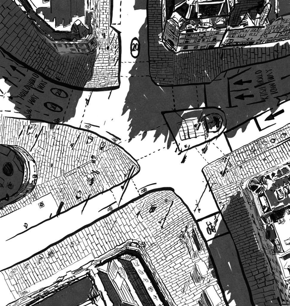
First of all, I entered this space through the medium of painting and depicted each building that I saw within this space. First, I observed this place from a bird’s-eye perspective, which was also the way I perceived it.
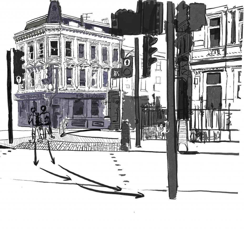
However, in order to obtain a more comprehensive observation, there was no place on the site that could provide me with a very comprehensive overview. Therefore, I chose to combine Google Maps with the situation I saw on the spot to create an overview map of this place.
Observe my movement
So I tried to start with myself and see how I was using this place. First, I started with the lines of my movement at this intersection using GPS. However, each individual view might not accurately reflect this pattern. To better observe it, I used the paths of the public facilities here and further explained the GPS route using the pen tool from photoshop.
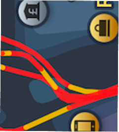
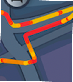
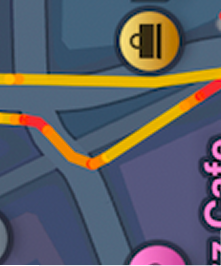
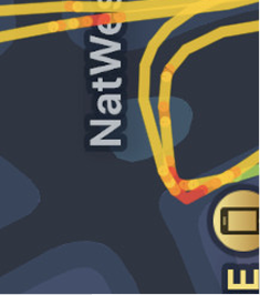
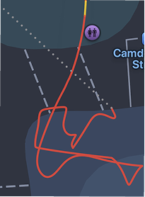
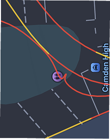
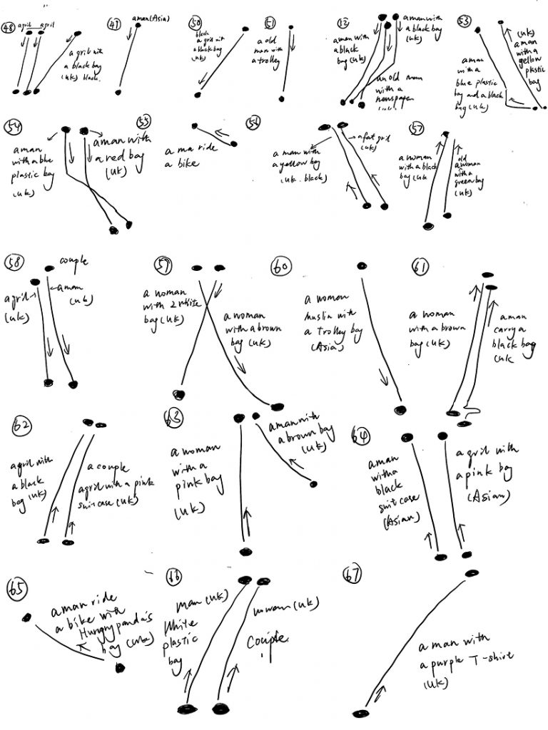
I observed that my usual behaviour at this intersection was to pass through quickly in a straight line, and almost within the area of the zebra crossing. Because I have noticed that the use of public facilities in this space, such as different zebra crossings, is often due to shopping. However, the purposes for which other people use this space are different, and their use of the infrastructure is also different. Even when two people walk together, their use of this space can change. But people’s walking speed is very fast, and they only spend a few seconds passing through this intersection. Therefore, in order to quickly capture the dynamic information of the scene, I used dots to represent where people stood from A to B, and used lines to show their paths. I also quickly wrote down the physical characteristics, clothing, and belongings of the pedestrians, and whether they were walking together. I hope that through these details, we can reveal the deeper story behind this location.
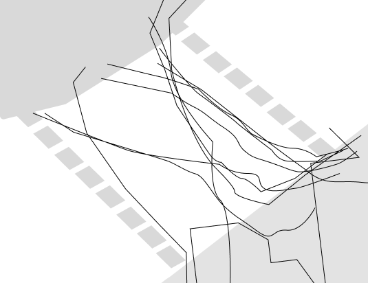
Observe People’s movement
When organising these observation samples, I found that the people passing through this intersection showed obvious group characteristics: most were local residents of the UK, and there were also a few Asian groups. To explore the potential commonalities and differences between these two groups, I divided the observation subjects into two groups: local residents of the UK and Asians, overlapped and compared their movement and behavioural patterns. I hoped to gain new spatial insights from the interweaving of clues.
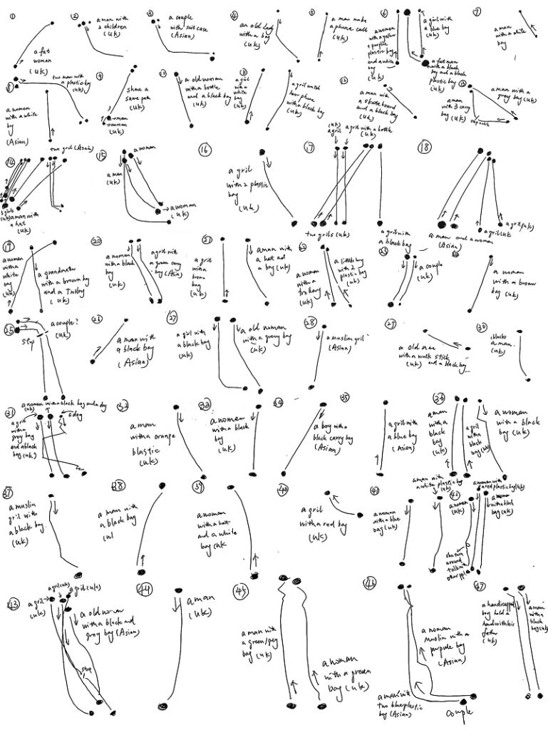
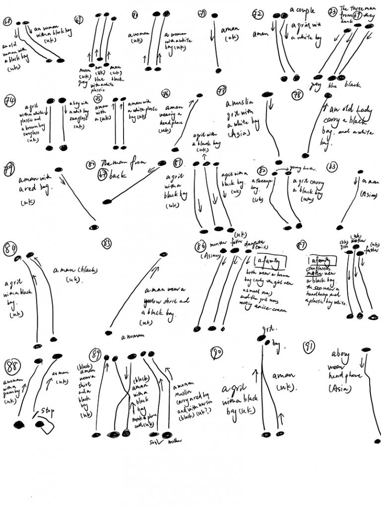
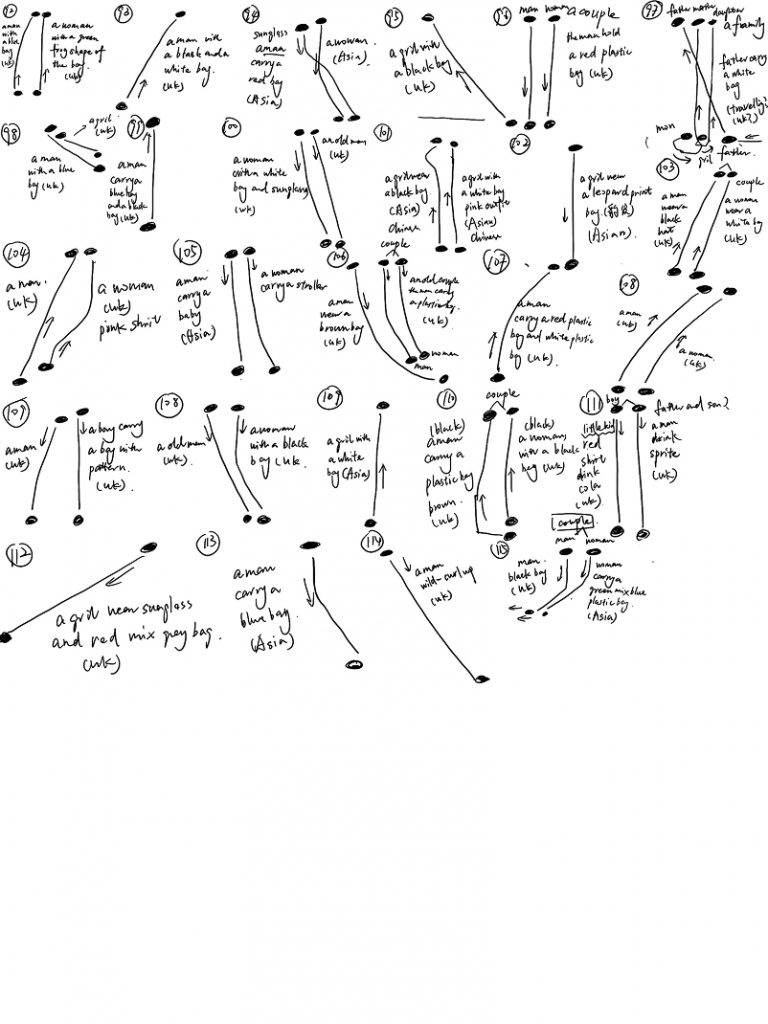
During a one-week fixed-point observation, a total of 24 Asians crossed this crossroad. To deeply explore the walking behaviour characteristics of Asian pedestrians, I extracted the movement of this group and then overlaid it onto a map for visual comparison of differences in movement and belongings among different individuals.
Through the movement analysis, the walking patterns of Asian pedestrians demonstrated extremely high directness, such as directly approaching point B from point A, all in the zebra crossing range. To further verify this feature, I divided this group into two opposing sub-flow directions based on the walking direction. The analysis showed that when these two opposing flows met, they exhibited spontaneous avoidance behaviour and induced a minor flow diversion and dynamic balance in the centre of the zebra crossing, revealing the self-organisation laws of a small group of people in this space.
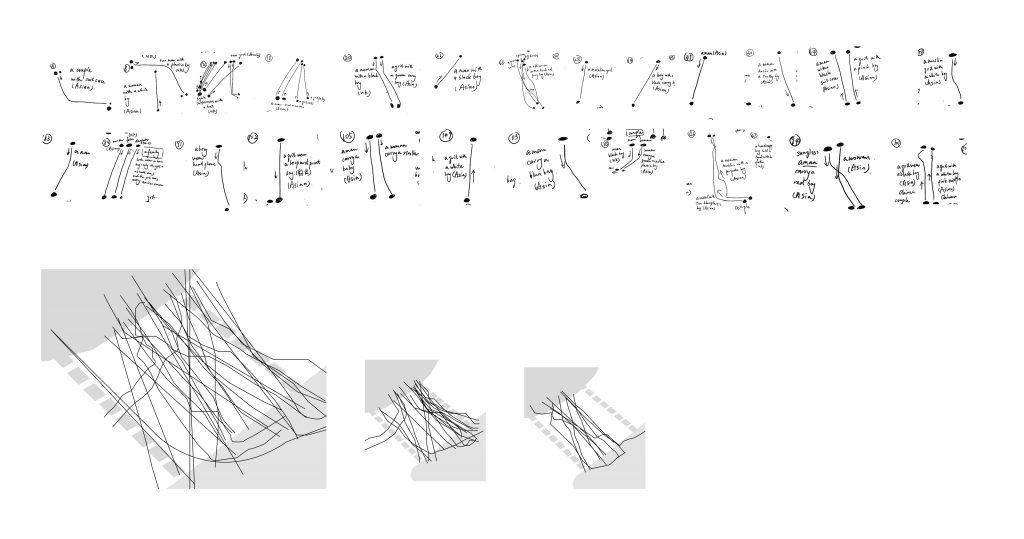
On the left at the bottom is the path for Asia, in the middle is the one coming from the opposite direction, and on the right is the path leading to the opposite side.
UK pedestrian
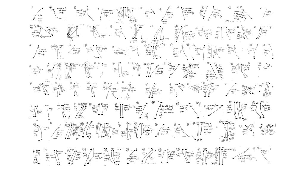
Due to the significant proportion of local residents in the sample data, their behavioural characteristics are more diverse, including cyclists, people carrying supermarket shopping bags, families, couples, and other groups. After vector overlay of the movement of the local people, two core finding are revealed:
1 Cover the entire space:The movement of UK pedestrians does not remain confined to the centre of the zebra crossing but extends in a scattered manner throughout the crossing area and the corners. This reflects that local residents, with a high familiarity of the place, have a stronger desire for spatial exploration and autonomous movement.
2 Pedestrians taking different routes: Some pedestrians spontaneously choose to pass along the outer ends of the zebra crossing, naturally forming an efficient and orderly “dual-channel” flow in the dynamic movement.
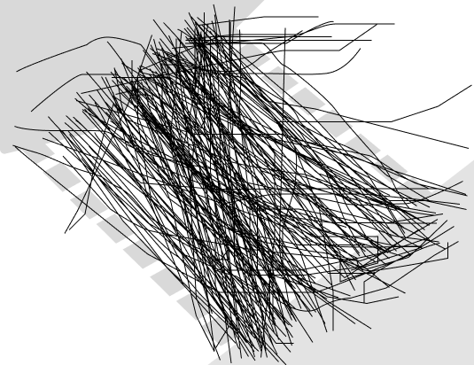
In order to better summarize their similarities and differences, I will connect all of them together and identify the similarities and differences among them
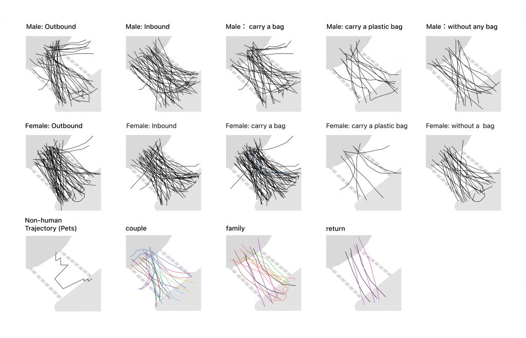
Overall, a large number of paths are concentrated within the area defined by the zebra crossing, but only a small number of people’s paths extend to the edge. Most of these people do not come from either end of the zebra crossing but walk directly from a certain intersection or some people who choose to pass by riding a bicycle. This indicates that there is some overlap in the routes of pedestrians, but not all people move along exactly the same route.
The paths of those carrying ordinary bags, plastic bags, and those without bags are of different densities. The movement of those people with bags is relatively more complex, possibly because the items they are going to purchase are different, or because the weight of the items makes their paths more complex, especially for the plastic bag group, and the vast majority of the plastic bags come from the surrounding stores. It should be emphasised that those without any large personal belongings have very direct A-to-B linear movement in this space. Therefore, the items that people carry will affect their use of this spatial infrastructure to some extent.
In the movement routes of two or more people, their movement paths tend to be more similar. For instance, they may get closer to each other, turn together, and stop simultaneously or one after the other at certain positions.
Feedback:
Writing some different paths will be interesting, like why some people run a red light at this intersection, or how a lot of people passing this crossroad will have different paths. or just not only focus on just people , regarding cars, bikes, or brids how their path would like? Developmental mapping through different types of transport. Most of the detail is missing throughout this; maybe you can just go back to the first pages, the painting, or use voiceover to record people talking.I need to have more details rather than just use one single way to research the outcome. Mapping will also reflect some new things; try to go back to the reading like Mitch Miller‘s method.
Just focus on painting, like some different story, not just focus on the world, or I can just paint some people who just pass by, just like an informal story from different people
Leave a Reply